
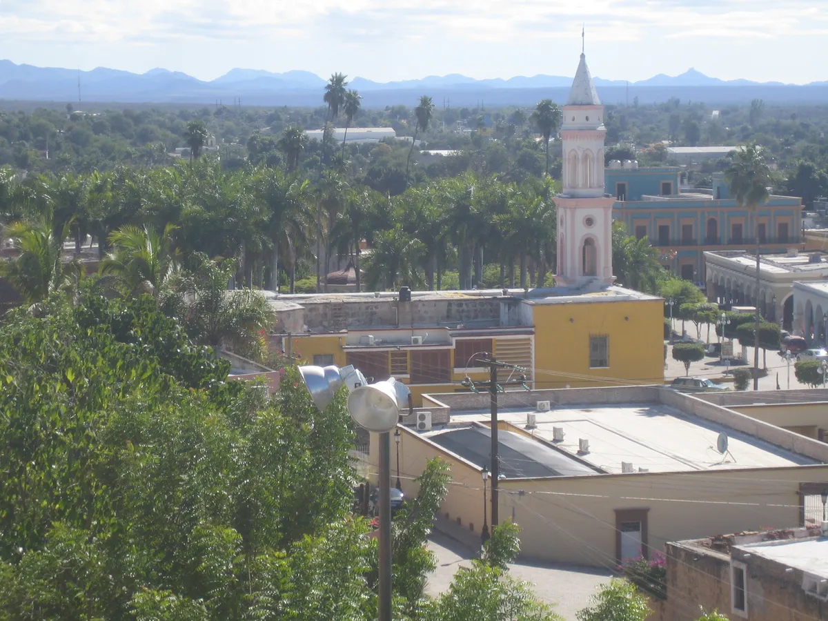
El Fuerte
A historic town in northeastern Sinaloa, on the Río Fuerte at the foot of the Sierra Madre Occidental. It was an administrative and trading centre in the colonial period and is part of the federal Pueblos Mágicos programme.
Key facts
- Municipal seat
- El Fuerte
- Population
- 96,593 · 2020
- Occupied dwellings
- 26,499 · 2020
- INEGI code
- 25010
Overview
El Fuerte keeps a colonial street plan around its square and the reconstruction of the fort that gives it its name. It has a station on the El Chepe train (the Chihuahua–Pacific Railway), where travellers board for the Copper Canyon, and Yoreme (Mayo) communities live in its surroundings.
The municipal economy combines irrigated farming in the Río Fuerte district with cultural and nature tourism tied to the town and the nearby reservoirs.
History
Around 1563-1564 Francisco de Ibarra founded the Villa de San Juan Bautista de Carapoa, some way from the present site — the first Spanish settlement in the valley; sources disagree on the year. Destroyed and resettled several times, in 1610 Captain Diego Martínez de Hurdaide built the riverside fort — named for the Marquis of Montesclaros — that gave the place its lasting name.
Through the colonial era and the early years of independent Mexico, El Fuerte served at times as an administrative seat for the northwest and as a hub of the trade and mining routes toward the sierra and Chihuahua. The federal tourism ministry added it to the Pueblos Mágicos programme in 2010, though some sources date the designation to 2009.
- c. 1564
Founding of San Juan Bautista de Carapoa
Around 1563-1564 Francisco de Ibarra founds the Villa de San Juan Bautista de Carapoa, the first Spanish settlement in the valley and the forerunner of El Fuerte, some way from the present site. Sources disagree on the year.
- 1610
Building of the Montesclaros fort
Captain Diego Martínez de Hurdaide builds, around 1610, the fortified compound that gives the town its lasting name.
- c. 2010
El Fuerte named a Pueblo Mágico
The federal tourism ministry places El Fuerte's entry into the Pueblos Mágicos programme in 2010; some sources date the designation to 2009.
Geography
The municipality lies where the coastal plain gives way to the foothills of the Sierra Madre Occidental. The Río Fuerte runs through it and is regulated upstream by the Miguel Hidalgo (Mahone) and Josefa Ortiz de Domínguez (Huites) dams.
Relief and vegetation are more varied than in the coastal municipalities; the climate is warm, with summer rains.
Cities and localities
Municipal seat
Other localities
- Constancia · 6,775 residents (2020)
- Mochicahui · 6,055 residents (2020)
- San Blas · 5,789 residents (2020)
- Adolfo López Mateos (Jahuara Segundo) · 4,482 residents (2020)
- Charay · 3,041 residents (2020)
- Benito Juárez (Vinatería) · 2,272 residents (2020)
- Lázaro Cárdenas (Campo Esperanza) · 2,013 residents (2020)
- Dos de Abril · 1,856 residents (2020)
- Los Taxtes · 1,793 residents (2020)
The municipality contains 539 localities on the INEGI register.
Related topics
- Colonial history
- History
- Tourism
Related stories
- History
The deer and pascola dances among the Yoremes of Sinaloa
Among the yoremem — the Mayo people of northern Sinaloa — music and dance are not entertainment set apart from ceremonial life: they still accompany, today, the religious fiestas that mark the year.
Sources and data
The figures on this page come from public sources. Each data point shows its year and origin.
- Censo de Población y Vivienda 2020 — Principales resultados por localidad (ITER), Sinaloa — Instituto Nacional de Estadística y Geografía
- Panorama sociodemográfico de Sinaloa. Censo de Población y Vivienda 2020 — Instituto Nacional de Estadística y Geografía
- Enciclopedia de los Municipios y Delegaciones de México — Estado de Sinaloa — Instituto Nacional para el Federalismo y el Desarrollo Municipal (SEGOB)
- El Fuerte, Sinaloa — Programa Pueblos Mágicos — Gobierno de México